Drone Survey and High-resolution satellite imagery
Drone Survey and High-resolution satellite imagery
Precise layout and monitoring for construction projects, including as-built surveys and topographic mapping.
Drone Survey and High-resolution satellite imagery
Drone Survey Services Brochure (Text Version)
Comprehensive drone survey services in Egypt including photogrammetry, orthomosaics, DTM/DSM, thermal surveys, mining mapping, volume calculations, road and infrastructure surveys, and high‑resolution imaging. Operations comply with Egyptian regulations and international survey standards. Equipment includes multi‑rotor and fixed‑wing UAVs with RTK/PPK accuracy.
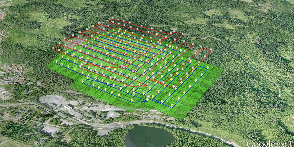
Scope of Work – Drone Thermal & Photogrammetry Survey (Gold Mining)
Establish GCPs using RTK GNSS.
UAV flights for photogrammetry (RGB) and thermal imaging.
Generate orthomosaic, DTM, DSM, contours.
Thermal anomaly mapping for geological assessment.
Volume calculations for excavation and stockpiles.
Includes: Project overview, flight logs, equipment used, accuracy assessment, GCP report, orthomosaic sample, thermal mapping results, 3D model screenshots, conclusions and recommendations.
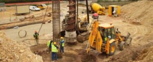
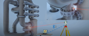
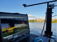
Image Set (Placeholder Notes)
Insert operational images such as desert mining sites, drone takeoff, thermal camera outputs, orthomosaic screenshots, and 3D terrain models.
Word Format Availability
This document contains all required sections. Individual documents can be separated if needed.
Zone Survey & Mapping complies with all national regulations and ensures that all drone missions are executed under valid permits, with full coordination with the Egyptian Civil Aviation Authority and security authorities.