Shaping the foundation of every project.
Using GNSS, total stations, and level instruments, we deliver accurate land data, including:
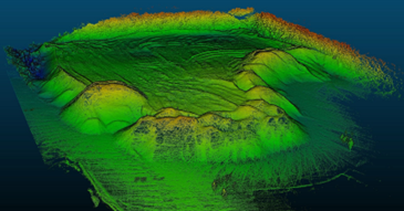
• Site boundary mapping
• Elevation and contour lines
• Identification of natural and man-made features
• Roads, utilities, and terrain profiling
This data supports design optimization, grading plans, and infrastructure development for engineering and architectural projects.
Software Used:
• AutoCAD Civil 3D
• AutoCAD
• ArcGIS Pro
• Leica Geo Office
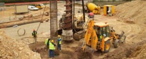
Equipment Used:
We are an authorized agent of Tersus GNSS.
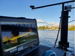
Their systems feature Tap technology, allowing single-receiver surveying without the need for a base station, using satellite corrections with 1.5 cm vertical and 2 cm horizontal accuracy, making it suitable for desert areas.
The device generates NMEA files, which makes it ideal for hydrographic surveying.
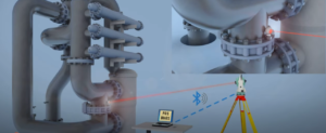
We are an authorized agent of the GeoMax Total Station from Leica, with a measurement and staking accuracy of up to 1 mm.
It is also capable of operating reliably for long periods in high-temperature environments.•
GNSS Systems: Trimble, Leica.
• Total Stations: Trimble, Sokkia.
• Level Instruments: including Leica, Sokkia, and Topcon levels capable of sub-millimeter accuracy, ensuring highly precise elevation measurements for critical infrastructure and construction works.
• TAP Technology: a subscription-based correction technique that enables high-accuracy GNSS correction without the need for a base station — streamlining field workflows and reducing setup time.